Gaza Emergency Strategy: Executive Summary
CRS has supported vulnerable communities in Gaza, the West Bank, and East Jerusalem since 1961 and has maintained a continuous presence in the Gaza...more
Fact Sheet | March 28, 2018
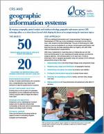
By merging cartography, spatial analysis and database technology, geographic information systems (GIS) technology allows us to share lessons learned while shaping the future of our programming for maximum impact. This fact sheet gives an overview of how CRS uses GIS in its programming.


Trusted by charity rating agencies:


©2024 Catholic Relief Services228 W. Lexington St. Baltimore, Maryland 21201-3443877-435-7277[email protected]
Catholic Relief Services eases suffering and provides assistance to people in need in more than 100 countries, without regard to race, religion or nationality.


We are the official overseas relief and development agency of the United States Conference of Catholic Bishops and a member of Caritas Internationalis.